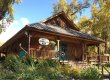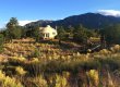


Willow Lake, far above Crestone
‘Looking for a Good Hike near Crestone?
The map below shows trailheads for some short hikes near town and for longer hikes into the high country of the Sangre de Cristo Mountains (see descriptions below the map). Some of these trailheads are within walking distance of the Delightful Dome (see Hikes around the Delightful Dome), but generally they are accessed by car. Below, we describe some of the Short Hikes Near Town, Longer Hikes into the Sangre de Cristo Mountain, and some ‘Trails Less Traveled’.
Open the Map in a New Browser Window or on your Smartphone

Short Hikes Near Town
The Ziggurat, located south of town, is a spiral-shaped tower with fantastic views of both mountains and valley, including the Sand Dunes located to the south. The tower, which is a short hike from parking (<1/2 mile), provides a nice introduction to altitude and the scenery
The Lower South Crestone Creek Trail starts from South Crestone Park, and meanders up through pleasant forests of cottonwooks and aspens, eventually reaching the Willow Creek Trailhead (approx. 2 miles). The trail follows the south side of the creek lower down, and the north side of the creek further up. It’s a lovely hike at any time of year.
Tashi Gomang Stupa is located far to the south of Crestone at the end the main road through the Baca. Park at Shumei International Institute or about 1 mile south of the Institute near a large water tank, and walk the rough road south to the stupa (2 miles from the Institute). Nice views of the valley – a beautiful and special place!
From the Town of Crestone, a well-traveled trail heads south through forest and open space, and then west and uphill towards the Burnt Gulch trailhead, South Crestone Creek, and the Willow Creek Trailhead. This is a nice way to get some fresh air if you are already in town.
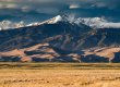
Longer Hikes into the Sangre de Cristo Mountains
Crestone is a hub for a number of US Forest Service trails that climb into the Sangre de Cristo Mountains. You can find details of these routes on the All Trails website or app – links below – a free account is needed to access the trail information.
The Willow Lake Trail starting east of town is the most popular trail into the high country. The trail climbs into the Willow Creek drainage and ascends to Willow Lake, which is backed by a beautiful water fall cascading into the lake (approx 10 mile round trip, 5-6 hours). Challenger Peak can be climbed from Willow Lake.
Other Forest Service Trails into the high country include the South Crestone Creek Trail (also starting at the Willow Creek Trailhead), the North Crestone Creek Trail (north of town), and the Cottonwood Creek Trail (south of town).
Trails Less Traveled
The old Liberty Postal Road heads south towards the Sand Dunes, access from Liberty Gate. Head south down a long hill and take the right fork on the far side of the wash. More details here.
Burnt Gulch Trail is an unmaintained leading north from a large parking area on the road to the Willow Creek trailhead. Trails also head on BLM land north of town. These trails are visible on the satellite image (above) – zoom in for details.